Description
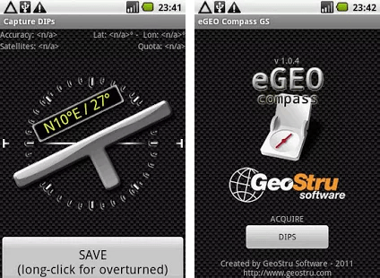
eGeoCompass is an application that turns a mobile device based on the Android operating system into a digital compass for geology.
eGeoCompass can be used to measure the orientation of geological surfaces such as soil surfaces, faults and fractures.
The application uses three sensors commonly available in all the smartphones equipped with the Android operating system: the GPS, accelerometer and compass.
Through the acquisition of dynamic data collected from these three tools built into the mobile device, the software calculates in real-time: – Immersion – Inclination– Latitude, Longitude and Altitude.
These values are captured as measurements at the user’s request and are stored in an integrated database in the program.
Collected data can be:
-
- Shown as a list of measurements and individually enriched with specific notes;
- Plotted as joints on a map based on satellite imagery from Google Maps;
- Exported in CSV (Comma Separated Values) format, having also the possibility to be deleted by the user.
The application allows obtaining a measurement in less than 5 seconds without requiring using tools other than the device itself. This means that the sampling times are drastically reduced, and the error in transcribing the values acquired through analogue compasses is avoided.
The result is a general optimization of the exploration and survey phases obtained through the native digitization of the data collection process.
