Descripción
Personalización del análisis
Es posible elegir las diversas formas de tratar los datos, eligiendo los métodos más adecuados para la suma direccional de las trazas en las direcciones horizontales, para el suavizado de datos y para la banda de frecuencia a analizar.
Entre las sumas direccionales disponibles, de hecho, es posible elegir desde la media aritmética más simple hasta la media cuadrática o geométrica. Entre los métodos para suavizar datos, sugeridos por el proyecto SESAME , podemos elegir: Konno & Ohmachi, Triangular constante y Triangular proporcional. Puede elegir las ventanas de tiempo para incluir y excluir simplemente con una marca de verificación, viendo los cambios en los cambios realizados en tiempo real. Todo respaldado por la capacidad de filtrar los datos de entrada automáticamente.
Visualización de datos
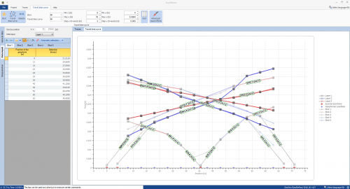
Todos los resultados se representan en gráficos personalizables. Los gráficos disponibles son: las trazas en las tres direcciones bajo análisis con la representación de las ventanas de tiempo elegidas; el espectro medio de las trazas;
el mapa para verificar la estacionalidad de la grabación; el mapa para verificar la isotropía direccional de la grabación; la relación espectral H/V con su intervalo de confianza con la posible superposición
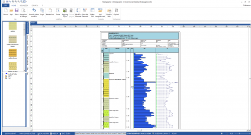
de la curva elíptica de varios modelos estratigráficos no únicamente del modo fundamental sino también de los superiores; la representación gráfica del perfil estratigráfico; el perfil de velocidad asociado con la estratigrafía.
Resultó
Le permite evaluar automáticamente una estimación inicial del modelo estratigráfico que mejor se aproxima al comportamiento espectral H/V registrado in situ y analizado para luego ‘ajustarlo’ y refinarlo más rápidamente. Así, además de la frecuencia natural de vibración de la estratigrafía propia de la técnica HVSR, se obtiene la evaluación inmediata de la Vs, eq y el perfil de velocidad de onda de corte del modelo estratigráfico hipotético. Además de la propia curva H/V con su intervalo de confianza, en el gráfico de relación espectral H/V son visibles, por tanto, todas las curvas elípticas de los distintos modos de cada modelo estratigráfico que el usuario puede decidir añadir. De esta manera es posible comparar las diferencias desde un punto de vista cualitativo, y se añade también una comparación cuantitativa con la estimación de la función de desajuste entre la curva elíptica fundamental y la de la relación espectral H/V. Todo ello acompañado de las comprobaciones de la fiabilidad de la curva H/V y su pico sugerido por el proyecto SÉSAMO.
Prueba & ChangeLog
PRUEBA
Puede solicitar una versión de prueba de este producto. Solicite aquí la versión de prueba.
2026.26.8.1026 | 31 de August de 2026 Optimization search algorithm resonance frequency
VERSION 2026
- Implmented Bing Maps for locations.
- Added support to make the application independent from the international options and language defined within the Control Panel of Windows. The software will use, however, the point as a decimal point and comma for digit grouping.
- Improvement of drawings export in the final report.
- Introduced an improvement in the calculation of smoothing with the techniques Triangular constant, Triangular proportional and Moving average.
- Improved the processing with customed duration windows.
- Implemented the import of drm format files.
- Implemented the export of the stratigraphy in .edp files.
- Implemented the possibility to contact GeoStru Staff directly from the software.
- Implemented the export of the H/V spectrum in csv format to be used for comparisons with various acquisitions.
- Improvement in the management of the graphics of the H/V spectra.
- Improvement in the management of the inversion models.
- Improvement in the export of H/V graphics for the print reports.
- Improved the import of SEG2 files.
- Implementation of an autonomous system of notification and download of upgrades.
- Added new functions for editing the computation report.
- Ability to change the display scale for the graphics of given traces.
- Optimization of SEG2 file import.
- Optimization of trace import from saf files.
- Display of the coordinates of the H/Vspectral ratio points in the corresponding graphic.
|
|---|
2026.26.4.994 | 21 de January de 2026 VERSION 2021
- Implmented Bing Maps for locations.
- Added support to make the application independent from the international options and language defined within the Control Panel of Windows. The software will use, however, the point as a decimal point and comma for digit grouping.
- Improvement of drawings export in the final report.
- Introduced an improvement in the calculation of smoothing with the techniques Triangular constant, Triangular proportional and Moving average.
- Improved the processing with customed duration windows.
- Implemented the import of drm format files.
- Implemented the export of the stratigraphy in .edp files.
- Implemented the possibility to contact GeoStru Staff directly from the software.
- Implemented the export of the H/V spectrum in csv format to be used for comparisons with various acquisitions.
- Improvement in the management of the graphics of the H/V spectra.
- Improvement in the management of the inversion models.
- Improvement in the export of H/V graphics for the print reports.
- Improved the import of SEG2 files.
- Implementation of an autonomous system of notification and download of upgrades.
- Added new functions for editing the computation report.
- Ability to change the display scale for the graphics of given traces.
- Optimization of SEG2 file import.
- Optimization of trace import from saf files.
- Display of the coordinates of the H/Vspectral ratio points in the corresponding graphic.
|
|---|
2022.26.4.963 | 22 de February de 2023 New release 2022, Bug fix in manual selection
|
|---|
2021.24.4.833 | 20 de May de 2020 New release
|
|---|
2020.24.4.733 | 29 de November de 2019 Version 2020 has been released
|
|---|
2018.24.4.633 | 30 de September de 2018 General bug fix
|
|---|
2018.23.4.533 | 7 de July de 2018 Export confidencial curve H/V
New release 2018. Calculate vs,eq.
|
|---|
2017.23.4.333 | 14 de September de 2017 Major release of HVSR 2017
|
|---|
2016.23.4.163 | 15 de December de 2015
- Optimization search algorithm resonance frequency
- Implemented Bing Maps for locations.
- Added support to make the application independent from the international options and language defined within the Control Panel of Windows. The software will use the point as a decimal point and a comma for digit grouping.
- Improvement of drawings export in the final report.
- Introduced an improvement in smoothing calculation with Triangular constant, Triangular proportional and Moving average techniques.
- Improved the processing with customed duration windows.
- Implemented the import of drm format files.
- Implemented the export of the stratigraphy in .edp files.
- Implemented the possibility of contacting GeoStru Staff directly from the software.
- Implemented the export of the H/V spectrum in csv format to be used for comparisons with various acquisitions.
- Improvement in managing the graphics of the H/V spectra.
- Progress in the direction of the inversion models.
- Improvement in the export of H/V pictures for the print reports.
- Improved the import of SEG2 files.
- Implementation of an autonomous system of notification and download of upgrades.
- Added new functions for editing the computation report.
- Ability to change the display scale for the graphics of given traces.
- Optimization of SEG2 file import.
- Optimization of trace import from saf files.
- Display the coordinates of the H/Vspectral ratio points in the corresponding graphic.
|
|---|








Valoraciones
No hay valoraciones aún.