
Description
Rock falls 2D.
GeoRock 2D is a software for the rock falls 2D simulation using Lumped Mass and C.R.S.P. models.
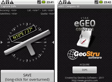
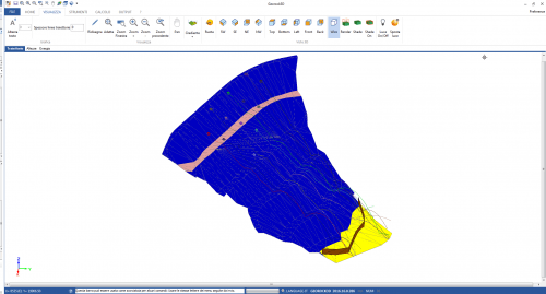
The software is interfaced with other GeoStru programs: TriSpace for automatically generating sections from an XYZ plane or raster images and GeoStru Maps, the new online App from GeoStru, that allows you to create topographic sections in a very simple way.
The fall trajectories can be divided into the following areas:
-
- transit area and stop area of 70% of the blocks;
- stop area of 95% of the blocks;
- stop area of 100% of the blocks.
Frequency not exceeding: 5, 50, 89, 95, 100%.
These areas are then assigned the relative hazard classes.
DATA INPUT
-
- Graphic input with the mouse (or another pointing device);
- Import from Excel;
- Import of DXF files;
- Import of topographic profile generated by TriSpace;
- Import of raster images;
- Automatic generation of topographic sections to be analyzed using GeoStru Maps.
CALCULATION METHODS
-
- CRSP method (Colorado Rockfall Simulation Program;
- LUMPED MASS method.
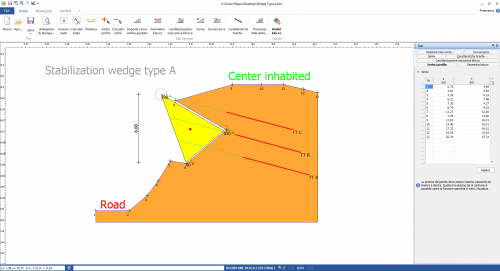
WORKS OF INTERVENTION
-
- Barriers.
GRAPHIC AND COMPUTATION OPTIONS
-
- Calculation type: statistical, deterministic;
- Boulder form: Spherical, Cylindrical, Disc;
- Function boulder attached to the slope;
- Function barrier attached to the slope;
- Point launch or definition of the launch area;
- Automatic identification of launch points;
- Animated display of bounce and impact;
- Display of all calculated trajectories;
- Selection of generic trajectory;
- Energy, Velocity, Flight time, and Parabola height information at any point of the trajectory;
- Display of kinematic parameters relative to the barriers;
- Display of percentage of boulders passing defined points on fall path;
- Georock 2D interfaces with Georock 3D for the analysis of three-dimensional rock fall.
STANDARD
UNI 11211/2012 (NTC 2008) and UNI 11211/2018 (NTC 2018) standards with the possibility of defining the various partial safety coefficients for both the Maximum Energy Level (MEL) and the Service Energy Level (SEL); The resistance of the rockfall barriers (kinetic energy) that can be defined for the two energy levels MEL and SEL;


maurizio azzola (verified owner) –
programma intuitivo e semplice da usare, completo nelle analisi
filippo catanzariti (verified owner) –
send you this email on behalf of M…TER Engineering, Tunisian consultancy which purchased from you a geostru software package since 2009.
Since we changed the PC used for these softwares, we would like please to get a new registration number relative to the software Georock 2D for the moment.
By the way, is there please an alternative to get a hardlock device so as we can use it instead of changing the codes from time to another.