|
From the compass to the stability report in a single web app, without installations. ͏ ͏ ͏ ͏ ͏ ͏ ͏ ͏ ͏ ͏ ͏ ͏ ͏ ͏ ͏ ͏ ͏ ͏ ͏ ͏ ͏ ͏ ͏ ͏ ͏ ͏ ͏ ͏ ͏ ͏ ͏ ͏ ͏ ͏ ͏ ͏ ͏ ͏ ͏ ͏ ͏ ͏ ͏ ͏ ͏ ͏ ͏ ͏ ͏ ͏ ͏ ͏ ͏ ͏ ͏ ͏ ͏ ͏ ͏ ͏ ͏ ͏ ͏ ͏ ͏ ͏ ͏ ͏ ͏ ͏ ͏ ͏ ͏ ͏ ͏ ͏ ͏ ͏ ͏ ͏ ͏ ͏ ͏ ͏ ͏ ͏ ͏ ͏ ͏ ͏ ͏ ͏ ͏ ͏ ͏ ͏ ͏ ͏ ͏ ͏ ͏ ͏ ͏ ͏ ͏ ͏ ͏ ͏ ͏ ͏ ͏ ͏ ͏ ͏ ͏ ͏
|
| |
Hi ,
We are thrilled to introduce the next generation of geomechanical surveys: GMS NX. We have reimagined your workflow to take you from the compass on the rock face directly to the stability report, all within a single web app that requires no installations or hardware keys:
- Field surveys with Compass NX: Replace expensive traditional compasses with a free application. It installs directly from the browser, works offline, measures dip and dip direction, and saves exact GPS coordinates, photos, and voice notes for every single joint.
- Cable-free synchronization: Type the six-digit code generated by the phone into your PC desktop, and the joints will fly into your project securely and immediately, with no need for Wi-Fi or cables.
- 3D Integration (Drones and LiDAR): Import 3D point clouds (PLY and XYZ formats) from photogrammetric drones or scanners, even handling datasets with thousands of points. The 3D viewer helps you visually recognize discontinuity planes and automatically extracts their orientation with a single click.
|
|
|
|
| |
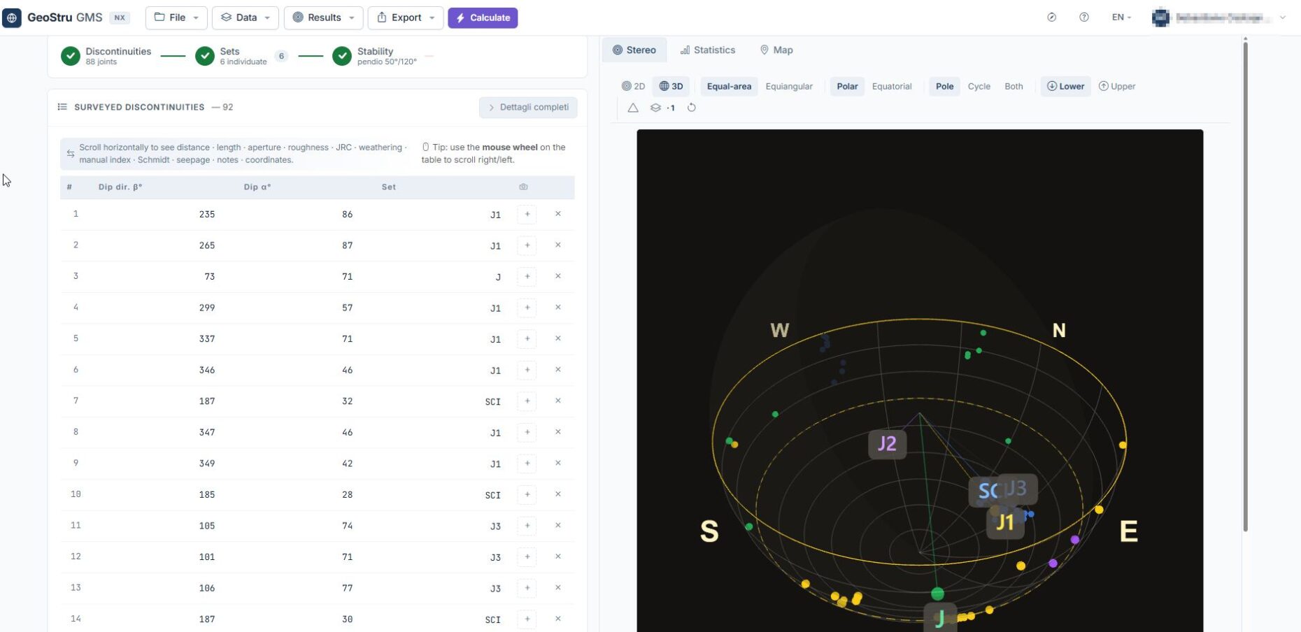
- Stereonet and Kinematic Analysis: Take advantage of the interactive HTML5 stereonet (Schmidt-Lambert or Wulff projections) and comprehensive joint statistics. The software automatically performs Markland's kinematic check and proactively suggests countermeasures for at-risk slopes (such as scaling, rock bolting, tiebacks, rockfall netting, reinforced gunite, and sub-horizontal drains).
- Integrated Artificial Intelligence: Simply paste the raw text of your notes; the AI will automatically extract the attitudes and project them instantly onto the stereonet.
- Georeferencing and Rapid Reporting: Every measurement is anchored on the real map using UTM projection (with your choice of OpenStreetMap, topographic, or satellite backgrounds). With one click, you can export a structured Word report, DXF files for AutoCAD, CSV tables of the attitudes, and high-resolution vector graphs (SVG or PNG).
|
|
|
|
| |
🎥 Watch the video about GMS NX
Watch the GeoStru GMS NX video on our YouTube channel!
|
|
|
|
| |
The GMS NX application is available on the geostru.ai platform. Open it, it's already there
Best regards, The GeoStru Team
|
|
|
|