How to create a geological and geotechnical model with GM3D ͏ ‌     ­ ͏ ‌     ­ ͏ ‌     ­ ͏ ‌     ­ ͏ ‌     ­ ͏ ‌     ­ ͏ ‌     ­ ͏ ‌     ­ ͏ ‌     ­ ͏ ‌     ­ ͏ ‌     ­ ͏ ‌     ­ ͏ ‌     ­ ͏ ‌     ­ ͏ ‌     ­ ͏ ‌     ­ ͏ ‌     ­ ͏ ‌     ­ ͏ ‌     ­ ͏ ‌     ­ ͏ ‌     ­ ͏ ‌     ­ ͏ ‌     ­ ͏ ‌     ­ ͏ ‌     ­ ͏ ‌     ­ ͏ ‌     ­ ͏ ‌     ­ ͏ ‌     ­ ͏ ‌     ­ ͏ ‌     ­ ͏ ‌     ­ ͏ ‌     ­ ͏ ‌     ­ ͏ ‌     ­ ͏ ‌     ­ ͏ ‌     ­ ͏ ‌     ­ ͏ ‌     ­ ͏ ‌     ­ ͏ ‌     ­ ͏ ‌     ­ ͏ ‌     ­ ͏ ‌     ­ ͏ ‌     ­ ͏ ‌     ­ ͏ ‌     ­ ͏ ‌     ­ ͏ ‌     ­ ͏ ‌     ­ ͏ ‌     ­ ͏ ‌     ­ ͏ ‌     ­ ͏ ‌     ­ ͏ ‌     ­ ͏ ‌     ­ ͏ ‌     ­ ͏ ‌     ­ ͏ ‌     ­ ͏ ‌     ­ ͏ ‌     ­ ͏ ‌     ­ ͏ ‌     ­ ͏ ‌     ­ ͏ ‌     ­ ͏ ‌     ­ ͏ ‌     ­ ͏ ‌     ­ ͏ ‌     ­ ͏ ‌     ­ ͏ ‌     ­ ͏ ‌     ­ ͏ ‌     ­ ͏ ‌     ­ ͏ ‌     ­ ͏ ‌     ­ ͏ ‌     ­ ͏ ‌     ­ ͏ ‌     ­ ͏ ‌     ­ ͏ ‌     ­ ͏ ‌     ­ ͏ ‌     ­ ͏ ‌     ­ ͏ ‌     ­ ͏ ‌     ­ ͏ ‌     ­ ͏ ‌     ­ ͏ ‌     ­ ͏ ‌     ­ ͏ ‌     ­ ͏ ‌     ­ ͏ ‌     ­ ͏ ‌     ­ ͏ ‌     ­ ͏ ‌     ­ ͏ ‌     ­ ͏ ‌     ­ ͏ ‌     ­ ͏ ‌     ­ ͏ ‌     ­ ͏ ‌     ­ ͏ ‌     ­ ͏ ‌     ­ ͏ ‌     ­ ͏ ‌     ­ ͏ ‌     ­ ͏ ‌     ­ ͏ ‌     ­ ͏ ‌     ­ ͏ ‌     ­ ͏ ‌     ­ ͏ ‌     ­ ͏ ‌     ­ ͏ ‌     ­ ͏ ‌     ­ ͏ ‌     ­ ͏ ‌     ­ ͏ ‌     ­ ͏ ‌     ­ ͏ ‌     ­ ͏ ‌     ­ ͏ ‌     ­ ͏ ‌     ­ ͏ ‌     ­ ͏ ‌     ­ ͏ ‌     ­ ͏ ‌     ­ ͏ ‌     ­ ͏ ‌     ­ ͏ ‌     ­ ͏ ‌     ­ ͏ ‌     ­ ͏ ‌     ­ ͏ ‌     ­ ͏ ‌     ­ ͏ ‌     ­ ͏ ‌     ­ ͏ ‌     ­ ͏ ‌     ­ ͏ ‌     ­
Vedi sul Browser | unsubscribe | aggiorna profilo
‌
Logo
Geological and geotechnical BIM modeling
‌
‌

Dear ,

The design of a geological and geotechnical model requires in-depth local knowledge and a large amount of data provided by tests, surveys and other, necessary for an assessment of the surface lineaments, subsurface materials, their properties, bedding, site shape and the degree of risk present at the site.

We have a tool that will surely help you in your profession: GM3D - geological and geotechnical modeling software.

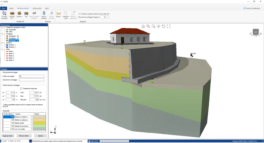
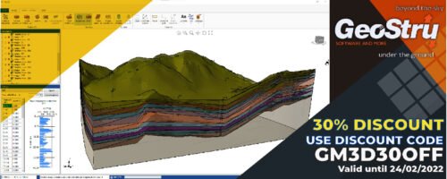
GM3D is a software for geological and geotechnical BIM modeling that, through 3D modeling algorithms, is able to reconstruct the three-dimensional stratigraphic model of the subsurface.

We have recently released the 2022 version with important new features, some of them presented below.

‌
‌

Modelling

gm3d ‌

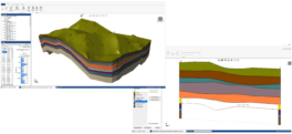
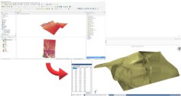
Quickly create 3D geological and geotechnical terrain models with integration of all types of structures and infrastructure.

‌
‌

‌ gm3d2-2

GM3D offers a geometric modeling approach and also a manual modeling approach, that is manually connecting the layers of the surveys.

‌
‌

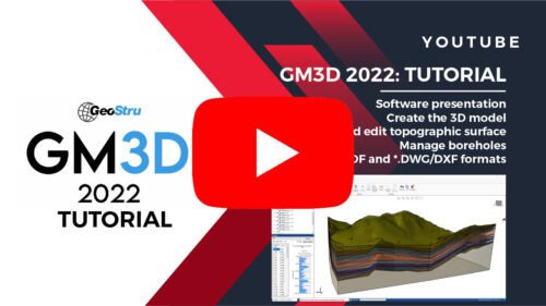
Watch GM3D's video tutorial on how to create 3D models of the subsurface.

‌
gm3d_en_youtube
‌

 Interoperability

gm3d_details_en ‌

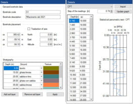
Perfect integration with all GeoStru software. Import and export of *.ags files for static and dynamic soil penetration tests, geophysical tests and GeoStru proprietary interchange files *.edp.

‌
‌

‌ slope_es

Export sections for other software like Slope, Georock 2D, Georock 3D and further stability analysis.

‌
‌

qgis ‌

Import site topography via GeoStru Maps or other GIS software.

‌
‌

Output

‌ autocad

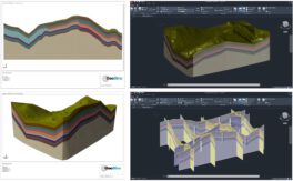
Once you have created your geological and geotechnical model you can export it to various formats including *.PDF and 3D models for AutoCad and Revit.

‌
‌
More information on GM3D
‌
‌

logo_newsletter ‌

Like all GeoStru 2022 desktop software, GM3D is integrated with the GeoDropBox cloud service, which extends the functionality of other file hosting services. In fact, it allows you to geolocate and store files, and always have them available from any device.

‌
risorsa-16
‌
You have received this email because you have subscribed to GeoStru as . If you no longer wish to receive emails please unsubscribe
© 2026 GeoStru, All rights reserved
Condividi questo su YoutubeCondividi questo su FacebookLinkedinInstagram
‌