
Description
TOPOGRAPHY SOFTWARE FOR:
-
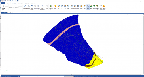
- Triangulations/Surfaces;
- Point triangulation with the option to indicate constraint lines, exclusion areas or perimeters (for lakes, ditches, etc.);
- Contour lines, with customized labelling;
- Wide choice of faded colours to highlight the level elevations (isolines);
- Interpolations;
- Isolines;
- Editable Voronoi diagram and Kriging;
- Linear and cubic interpolation (for roundings and approximations);
- Volumes calculation;
- Levelling with a horizontal plan;
- Levelling with the plane passing through three points;
- Levelling between two surveys;
- The intersection between surveys.
GENERAL FEATURES
-
- The input of point coordinates from the keyboard, with the possibility to indicate additional attributes, such as symbol, colour, whether it is a detail point or a drilling point;
- Numerous options for importing points: from DXF files, from Geostru Maps, from text files;
- Multi-layer management: work plans can be associated on each level;
- 3D view of individual surveys or complete levels;
- Choice of the axis of plan display (X,Y,Z);
- Duplicate analysis, guided point decimation;
- Standard graphic objects: texts, lines, polylines, arches, polygons, rectangles;
- Standard precision tools (SNAPs and guided mesh);
- Importing raster images with scaling;
- Plotting of slope vectors;
- Extracting three-dimensional information from Google Maps, Bing Maps.
NEW FEATURES
-
- Photorealistic rendering of the 3D model;
- Photorealistic rendering of the stratigraphy;
- “Link” graphic correspondence between sections and plan;
- View of multiple 2D sections;
- Positioning of works directly on the section;
- Section export, including works, for other GeoStru software.
SECTIONS
-
- The immediate longitudinal section is based on an arbitrary polyline;
- Longitudinal section through the union of points;
- Equidistant automatic sections;
- Three-dimensional section with interpolation of more surveys on different elevations;
- Three-dimensional section;
- 3D view;
- Animated 3D view for the survey.
EXPORT
All reports can be printed (also available as print preview) or exported in various formats: DXF, WMF, BMP etc.
HELP
The software has detailed online help.
ADDITIONAL NOTES
It interfaces with other GEOSTRU software for automatically plotting geotechnical or topographical sections.


Reviews
There are no reviews yet.