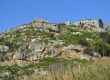
Rockfalls can be a major hazard and a threat to life, properties and infrastructure (highways, railways, bridges, power lines, pipelines, buildings, etc.).
Rockfalls are a natural process of cliff and hillside erosion. They consist of large rock fragments from a cliff, or boulders from a slope that bounce, roll, and slide down a hillside and come to rest in a “runout” zone at or near its base. Many different processes cause rocks to become unstable and fall including pore pressure increases due to rainfall infiltration, erosion of surrounding material during heavy rain storms, freeze-thaw processes in cold climates, chemical degradation or weathering of the rock, root growth or leverage by roots moving in high winds, seismic ground motions. Excavation for a road cut or building may also weaken bedrock support.
Once a rock block has detached from the steep slope, it will free fall, topple, bounce, roll or slide along the slope surface at a high speed, which can cause significant damages to the facilities at the foot of the slope.
A potential rockfall can be composed of either rock blocks cut by discontinuities and free faces or boulders and rock fragments on a soil or talus slope surface.
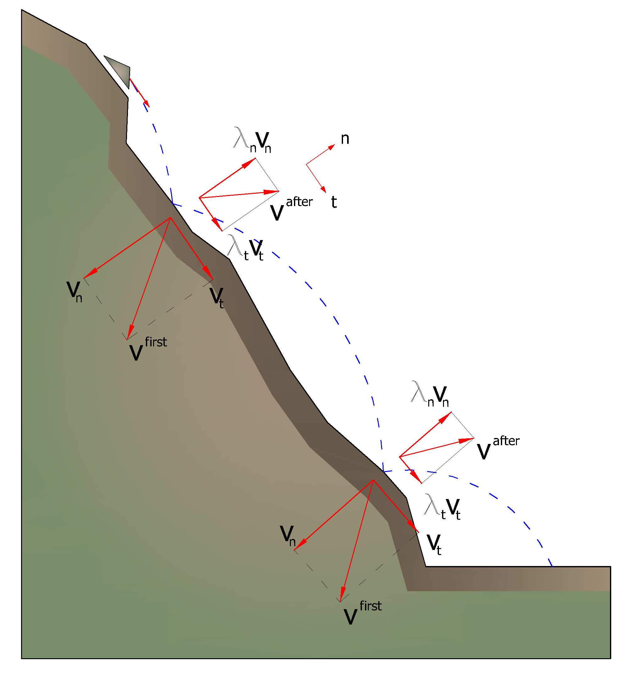
The geological factors that directly influence a rockfall hazard are the characteristics of the rock mass discontinuities and the rock strength. The spacing between discontinuities defines the size and shape of the rock block, and discontinuity orientation defines the type of initial instability mechanism (sliding, toppling). The rock strength influences the type of movement along the slope surface (bouncing, rolling, sliding). The travel distance of the rock block depends on factors such as the size of the block, the dip of the slope, the composition and the asperity of the slope surface. The most dangerous surfaces act as ‘ski-jumps’ and impart a high horizontal velocity to the falling rock, causing it to bounce a long way out from the toe of the slope. Clean faces of hard unweathered rock are the most dangerous because they do not retard the movement of the falling or rolling rock to any significant degree. Surfaces covered in talus material, scree or gravel absorb a considerable amount of the energy of the falling rock and, in many cases, will stop it completely.
[av_notification title=’Try the new 2016 version!’ color=’blue’ border=’dashed’ custom_bg=’#444444′ custom_font=’#ffffff’ size=’large’ icon_select=’yes’ icon=’ue82d’ font=’entypo-fontello’]
GeoRock 2D – 2D analysis of rockfalls!
[/av_notification]
The energy dissipated due to impacts is generally different and varies with the characteristics of the motion and depends on the mechanical characteristics of the boulder and on the materials present along the slope (rock, soil, vegetation) that oppose in a different manner to the motion of the boulders. In reality, however, it is practically impossible to determine precisely the contour of a slope and detect the shape of the different boulders that may detach. In addition, the geometry of the slope and the nature of the outcropping materials undergo changes over time, sometimes sensitive, as a result of the alteration of the rock, of the accumulation of debris in the less steep areas and of the development of the vegetation. Finally, it is practically impossible to model the motion of boulders fall in cases in which these shatter due to impacts, nor is it possible to identify the areas of the slopes where shatter occurs. For the analysis of the falling trajectories we need to refer to very simplified models: the geotechnical design of the protection interventions must be, therefore, developed on the basis of a large numerical experimentation, making it possible to explore the different aspects of the phenomenon and recognize the main factors that affect the motion of fall in the particular situation in question. In more complex cases it might be necessary to calibrate the model on the basis of an analysis of trajectories detected by in situ cinematography following the collapse of the boulders.
There are different models that can be used to analyze rockfalls.
For the Lumped Mass model, the computation assumptions are plan outline, slope profile similar to a broken line consisting of straight line segments, point boulder and neglectable air resistance.
The CRSP model (Colorado Rockfall Simulation Program) has been developed by Pfeiffer and Bowen (1989) with the purpose of modeling the falling motion of boulders having the shape of spheres, cylinders or discs, with circular cross section in the vertical plane of the movement. The reliability of the model was verified by comparisons between numerical results and those obtained from in situ tests.
 Lumped Mass model Lumped Mass model |

CRSP model |
Using statistical and deterministic calculation, the models can offer information regarding trajectories simulations, information on single trajectory, energy, impact velocity, flight time, etc. that are then used to design and optimised positioning of protection works (barriers, berms, fills, rocksher, ditches, etc).

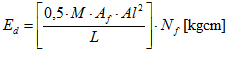
The proper functioning of a barrier depends significantly on the sizing of the structure components. The main elements are the nets that constitute the main interception structure of the blocks, that, when deforming, dissipate the kinetic energy of the impact. The value of the dissipated energy can be calculated using the following relationship:
where:
| M | elasticity modulus |
| Af [cm2] | area of the section of the ropes |
| Df [cm] | diameter of the ropes |
| Al [cm] | maximum elongation of the ropes |
![]()
| ap [%] | percentage elongation of the rope, generally equal to 8 |
| L [cm] | total length of a rope |
| Nf | number of ropes involved in the impact |
READ MORE about Barriers
Read more on the subject:
- Hoek, E (2002) Practical Rock Engineering, Chapter 9, Analysis of Rockfall Hazards
- Warren Stevens (1998) RocFall A Tool for Probabilistic Analysis, Design of Remedial Measures and Prediction of Rockfalls. University of Toronto, Canada
- L.R. Richards, B. Peng, D.H. Bell (2001) Laboratory and Field Evaluation of the Normal Coefficient of Restitution for Rocks, Proceedings of the ISRM Regional Symposium Eurock 2001, Espoo, Finland, 2001, pp. 149-155
GeoRock 2D software uses Lumped Mass and C.R.S.P. (Colorado Rockfall Simulation Program) models for a quick, easy and accurate analysis of rockfalls – TRY IT NOW!